Map Illustrator
Honolulu City Map
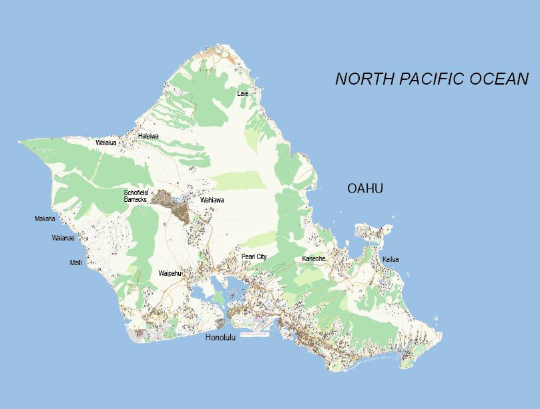
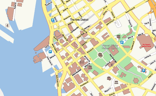
Detailed Honolulu City Map in vector file format you can edit in your own design software. Your topographic plan at street level contains editable layers for each cartographic category like roads, buildings, rivers, points of interests et cetera. This Honolulu City Vector Map includes not only the city centre, but the complete island of Oahu as well. This is what makes Map Illustrator stand out from other suppliers.
Specifications of the Vector Honolulu City Map
- File format: Adobe Illustrator CC, other file formats like .jpg, .pdf, .png or .eps are available on request
- File size: 20 MB
- Scale: 1:15.000
- Publishing date: May 2016
Benefits
- Save money: save tremendous time and money designing or printing your own city map
- No surprises: up-to-date, complete and high resolution cartography
- High quality: scale, crop or zoom to virtually any size without loss in detail or quality
- Copyright free: buy once, use as much as possible
- No risk: 30 days money back guarantee, no questions, no hassle
Honolulu facts
Honolulu, on the island of Oahu, is the capital and largest city of the state of Hawaii. It is the center of government, transportation, and commerce for the state; home to a population of nearly one million people in the metro area (80% of the state's population) and Hawaii's best known tourist destination, Waikiki Beach. The majority of visitors to Hawaii enter through this city, meaning this is definitely not the place to go for a "get-away-from-it-all" Hawaiian vacation - It is as fast-paced and dynamic as any city, with all its problems such as heavy traffic, drugs, crime, and homelessness. But Honolulu still has the charm of the Islands' laid-back atmosphere and culture.