Map Illustrator
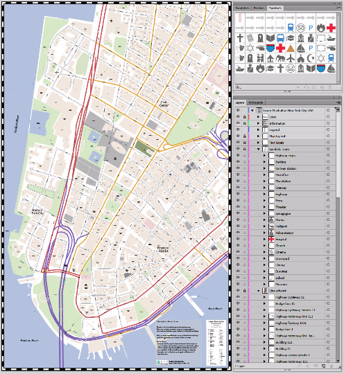
Lower Manhattan High Resolution Vector Map
$47.00
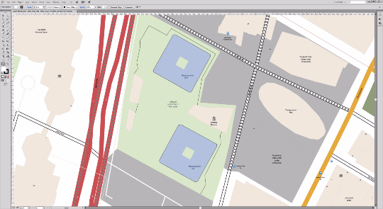
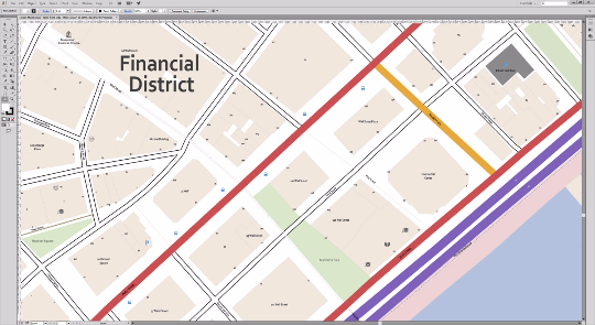
Save days of work when designing your own digital map. Our detailed city map contains editable layers for each map category like roads, one way directions, buildings, housenumbers, rivers, schools, bus stop, subway and train stations, churches, hospitals, ferries. This Manhattan map includes neighbourhoods like: Battery Park, the Financial District, Lower Manhattan and the Civic Center. Due to our daily updates of our mapping products, we always deliver the most accurate map available on the market. This is what makes Map Illustrator different compared to other map suppliers.
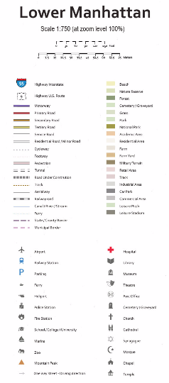
Scale: 1:750 or custom scale
Bounding box: Longitude -74.020266, Latitude 40.699919, Logitude -74.002169, Latitude 40.719208
Product Dimensions: 94,56 x 152,05 inches / 2401 x 3862 mm
File format: Abobe Illustrator CS6, CC™ and PDF. Divergent formats on request
Publishing date: 2015
Publisher: Map Illustrator
Advantages of the vector based map of Lower Manhattan:
- Up-to-date, complete and high-resolution map
- Customize every detail of your map
- Add your own custom graphics and map symbols
- Scale, crop or zoom to virtually any size without loss in detail or quality
Please contact us if you need a custom made city map