News — journalism
What Is Cartography?
design illustrator journalism Map vector
Cartography is the study and practice of all the facets of maps and map making. Everybody is involved with maps as a user. A growing number of people use digital maps or Geographical Information Systems to design their own maps. Good cartography is important because a well designed map communicates its message better than badly designed one. You will notice that the quality of maps varies widely. Some are adequate but not inspiring while others miss the point completely and fail to communicate their message at all. Graphical excellence consists of complex ideas communicated with clarity, precision and efficiency. However...
Custom map
city custom design journalism Map vector
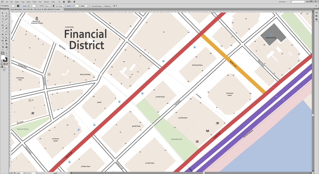
Your product or service deserves a made-to-measure map You need an appealing story in order to sell your concept, product or service. Tempt your target group with a beautiful map that visualises your solution. Designers, travel agencies, publishers, project developers, educational institutions, media companies and advertising agencies choose Map Illustrator for their made-to-measure maps. Please contact us if you need a quote for a specific map or cartographic solution. Maps ready to publish, print or edit Whether you need a small, highly detailed section of a larger area or a simplified map with the most up-to-date details, we will gladly...
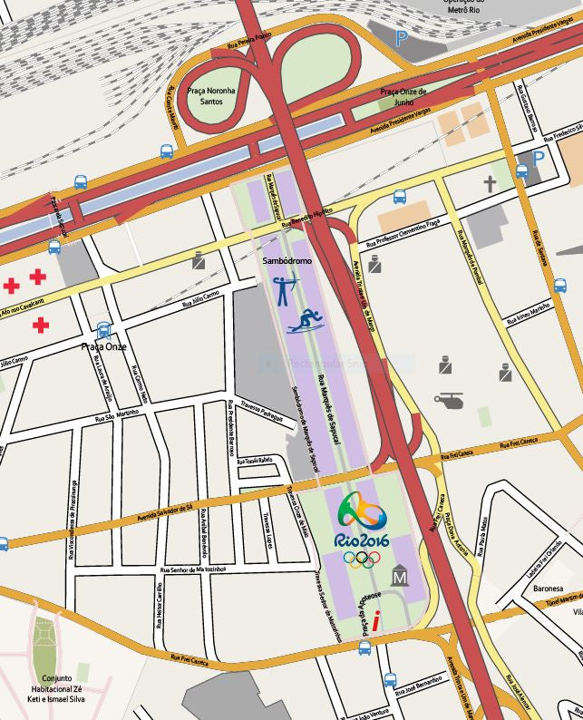
Olympic maps for journalists
city illustrator journalism Map Olympics RIO vector
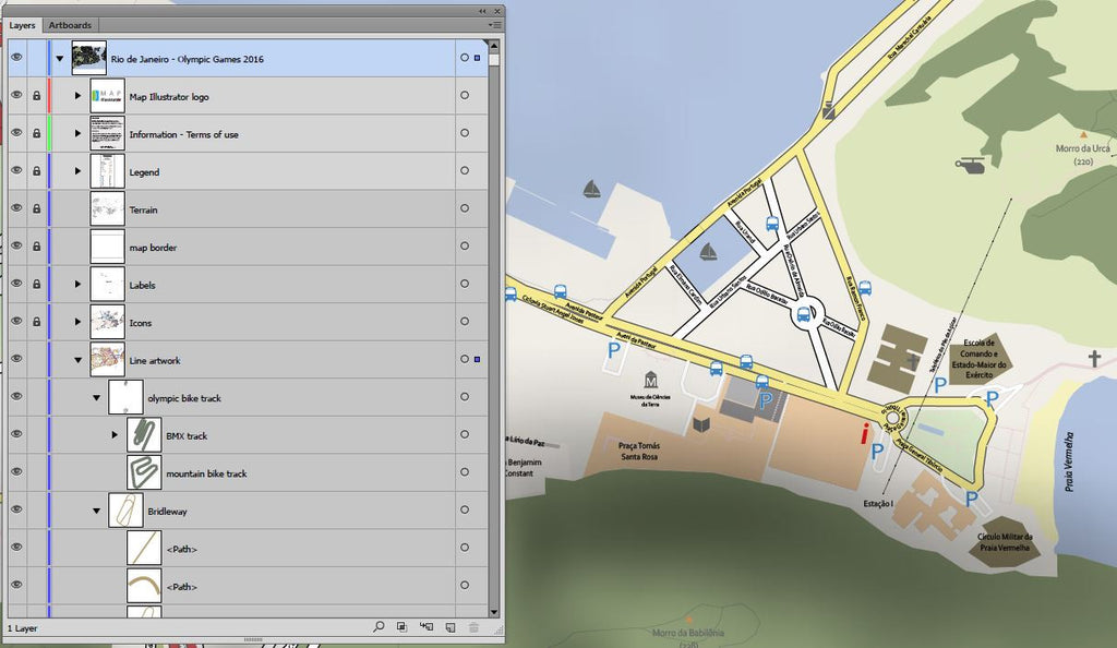
Maps can help illustrate news stories, give context to documentaries and add realism to dramas. If you'd like to use our maps in a newspaper, magazine, television programme or documantary then you can do so at no extra charge after buying an vector map of Rio 2016 Map.A journalist’s job is to get to the truth, or at least the point, so the reader can be more informed. Data can help expose facts that help a journalist tell important stories. Sometimes, visualizations of the data themselves can tell the story.Maps help unlock geographic data from the shackles of data sheets and sources....