News
High Res Vector Map of the Copacabana Olympic Area
Copacabana Games Map Olympics RIO
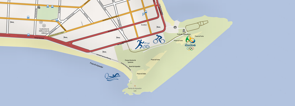
For Copacabana, the most internationally well known of the four regions, the Games will leave an environmental legacy. The Rio 2016 project provides for implementing existing initiatives to clean up the water around the neighborhood and protect other local environmental resources. The Glória Marina, the surroundings of Copacabana Fort, Rodrigo de Freitas Lagoon and Flamengo Park will be competition venues. Copacabana Beach will also receive a temporary stadium during the Games, for the beach volleyball competition. Do you want to save hours of design work creating a beautiful high resolution map of the Copacabana Olympic Area? Contact us today. Map...
Detailed Illustrator Map of the Barra Region in Rio de Janeiro
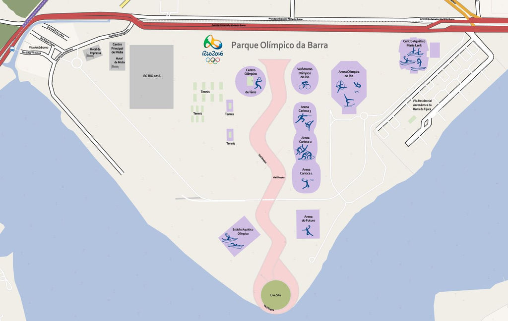
In the Barra region, Games-related projects include the construction of the Olympic Park, Athletes’ Village, Golf Course and Athletes’ Park. Within the Olympic Park, the city government is building new facilities in partnership with the private sector and the Federal Government, in addition to adapting some existing ones. The Olympic Park’s main legacy will be a permanent facility for Brazilian and South American sport: the Olympic Training Center. Competitons venues The three sports pavilions under construction, which will host a variety of competitions, as well as the Velodrome, Tennis Center and Maria Lenk Aquatics Center, will together make up the...