News — vector
Olympic maps for journalists
city illustrator journalism Map Olympics RIO vector
Maps can help illustrate news stories, give context to documentaries and add realism to dramas. If you'd like to use our maps in a newspaper, magazine, television programme or documantary then you can do so at no extra charge after buying an vector map of Rio 2016 Map.A journalist’s job is to get to the truth, or at least the point, so the reader can be more informed. Data can help expose facts that help a journalist tell important stories. Sometimes, visualizations of the data themselves can tell the story.Maps help unlock geographic data from the shackles of data sheets and sources....
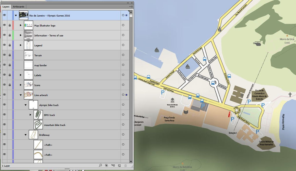
Rio de Janeiro City Map
city illustrator Map RIO vector
Rio de Janeiro city map Our detailed Rio de Janeiro (Рио-де-Жанейро, 里约热内卢, 里約熱內盧) city map (scale 1:16.500, or custom scale) contains editable layers for each map category like roads, buildings, rivers, et cetera. This Rio de Janeiro city map includes not only the city centre, but the suburbs as well. This is what makes Map Illustrator different compared to other map suppliers.File format: Abobe Illustrator CC™ or EPS. Divergent formats on request.Please contact us if you need a custom made city map. Advantages of the vector based city map of Rio de Janeiro Up-to-date, complete and high-resolution map Customize every...